


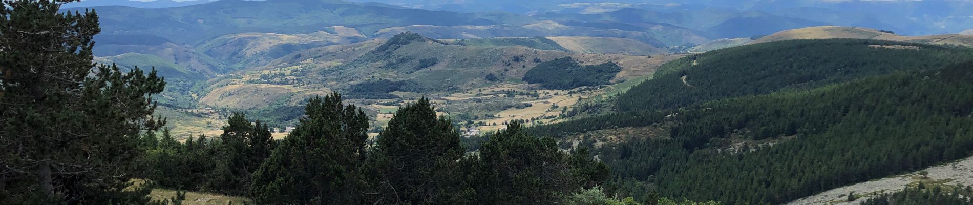
Mont Lozère, col Finiels

alinetpierre
User
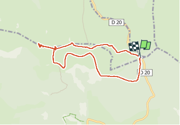

Length
8.3 km

Max alt
1699 m

Uphill gradient
174 m
Km-Effort
10.6 km

Min alt
1539 m

Downhill gradient
170 m
Boucle
Yes
Creation date :
2022-06-27 09:29:25.0
Updated on :
2022-06-27 12:16:17.311
2h06
Difficulty : Very easy

FREE GPS app for hiking
 SityTrail
IGN / Geographical institutes
SityTrail Plus
The world is yours!
About
Trail Walking of 8.3 km to be discovered at Occitania, Lozère, Mont Lozère et Goulet. This trail is proposed by alinetpierre.
Description
Superbe balade au mont Finiels, attention à la météo très vite changeante.
Photos


Positioning
Country:
France
Region :
Occitania
Department/Province :
Lozère
Municipality :
Mont Lozère et Goulet
Location:
Mas-d'Orcières
Start:(Dec)
Start:(UTM)
561135 ; 4919288 (31T) N.
Comments